In the Media
Video Presentations
I presented Understanding, analyzing and visualizing big data: A geospatial approach for the SDGs for the United Nations Department of Economic and Social Affairs Statistics Division Training Webinar: Integration of Geospatial Information and Statistics for the SDGs in the context of Big Data Oct 4, 2023.
Stadium General Utrecht University: Invited Speaking Series 2021
International Cartographic Association hosted this online this Webinar featuring all of the authors of our book titled: "Mapping for a Sustainable World" published by and with the United Nations and the International Cartographic Association.
State of the Map "Combating hegemonic cartographic discourses with drones"
Written media
Quoted in WIRED Magazine Online Drones are Turning Civilians into an Air Force of Citizen Scientists.
Quoted in YES! Magazine How Tenants Use Digital Mapping to Track Bad Landlords and Gentrification.
Interviewed for GeoHipster “Think about who the data is representing, and who is missing”
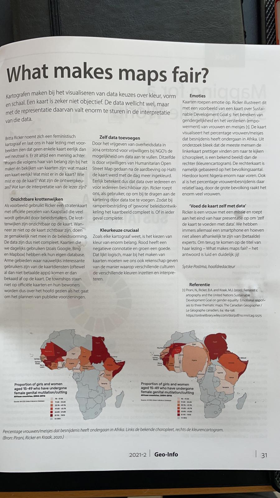
Utrecht University Stadium Generale speaking series wrote a Summary of my talk titled: "What makes maps fair?"
A Dutch Magazine for those working in the Geographic Information Science sector, including Surveyors and Geodessy experts also published a summary of my talk Geo-Information Netherlands
Below is a link to an online tutorial I prepared for a course that I contribute to in the Global Sustainability Science Program - this is about how to use QGIS.
Poster
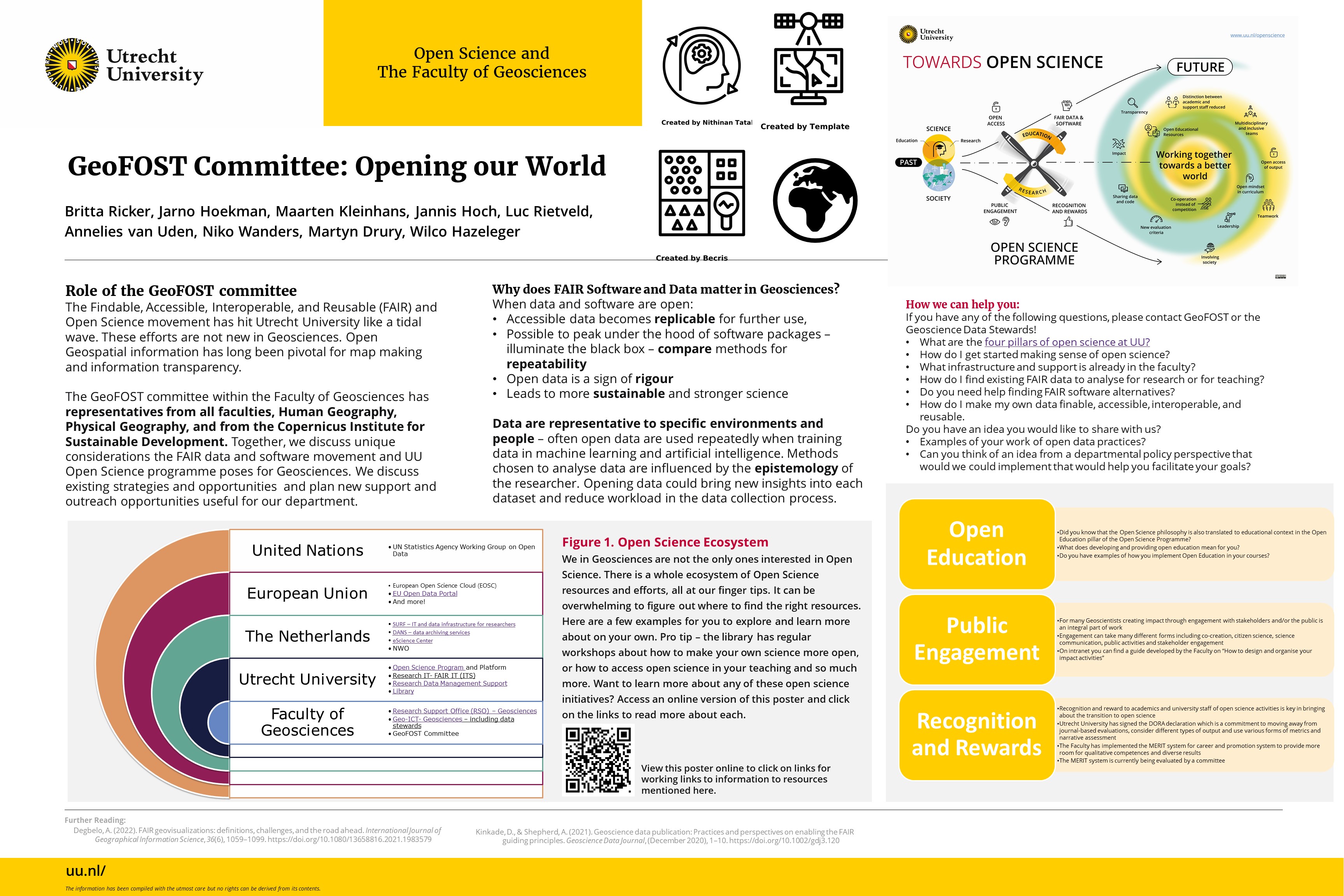
Here is a poster I created in 2022 with colleagues to present at the Faculty of Geosciences Research Day at Utrecht University. This poster highlights the important work we do in the GeoFOST committee promoting Open Science.
Online Presence elsewhere
- © Britta Ricker
- Design: HTML5 UP